2016
SS0597 : Cliff top chalet, Manorbier
taken 8 years ago, near to Manorbier, Pembrokeshire/Sir Benfro, Wales
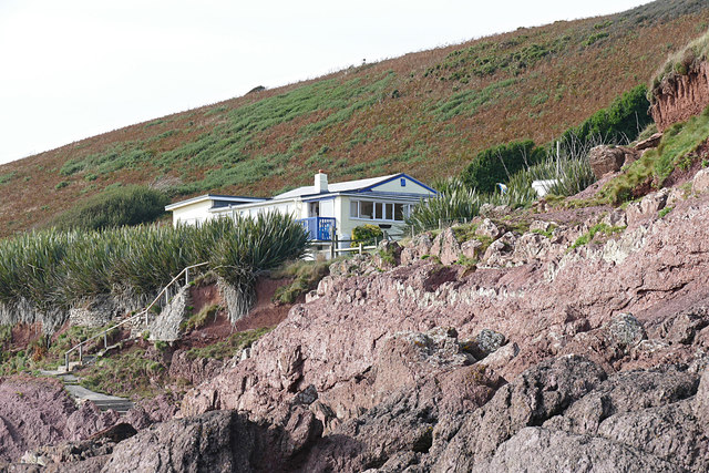
Cliff top chalet, Manorbier
The bungalow named The Dak on the road from Manorbier to Jameston, viewed from the rocks along the shoreline.
 Map © Crown Copyright")
TIP: Click the map for more Large scale mapping
- Grid Square
- SS0597, 106 images (more nearby 🔍)
- Photographer
- Alan Hunt (more nearby)
- Date Taken
- Thursday, 15 September, 2016 (more nearby)
- Submitted
- Thursday, 6 October, 2016
- Subject Location
-
OSGB36:
 SS 0585 9767 [10m precision]
WGS84: 51:38.6534N 4:48.4485W - Camera Location
-
OSGB36: SS 0586 9765
- View Direction
- North-northwest (about 337 degrees)