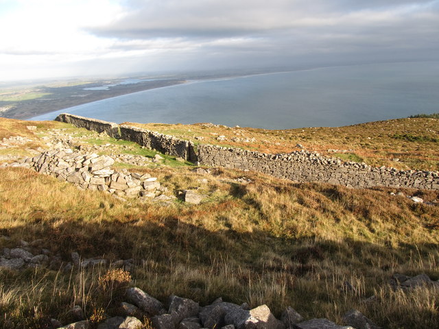
J3728 : The Belfast Water Commissioners' wall from Drinneevar Quarry
taken 7 years ago, 4 km S of Newcastle, Co Down, Northern Ireland
![Creative Commons Licence [Some Rights Reserved]](https://s1.geograph.org.uk/img/somerights20.gif)
|
· Find out How to reuse this image ·
Share:
|
|||||
| Start a discussion on J3728 | Suggest an update to this image | Contact the contributor | |||
Loading map... (JavaScript required)
- Grid Square
- J3728, 141 images (more nearby
 )
)
- Photographer
- Eric Jones (find more nearby)
- Date Taken
- Wednesday, 28 December, 2016 (more nearby)
- Submitted
- Saturday, 31 December, 2016
- Geographical Context
- Subject Location
-
Irish:
 J 376 287 [100m precision]
WGS84: 54:11.3453N 5:53.5202W - Camera Location
-
Irish: J 376 286
- View Direction
- Northeast (about 45 degrees)
This page has been viewed about 11 times.
View this location:
KML (Google Earth) ·
Google Maps ·
Bing Maps ·
Geograph Coverage Map ·
More Links for this image
·
Bing Maps ·
Geograph Coverage Map ·
More Links for this image