N3649 : Bridge on the Athlone to Mullingar Cycleway in Stokestown, Co. Westmeath
taken 7 years ago, near to Dysart, Co Westmeath, Ireland
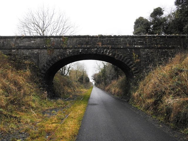
Bridge on the Athlone to Mullingar Cycleway in Stokestown, Co. Westmeath
Marked as a footbridge on the old 25" OS map but it seems more substantial than that.
![Creative Commons Licence [Some Rights Reserved]](https://s1.geograph.org.uk/img/somerights20.gif)
|
· Find out How to reuse this image ·
Share:
|
|||||
| Start a discussion on N3649 | Suggest an update to this image | Contact the contributor | |||
Loading map... (JavaScript required)
- Grid Square
- N3649 (more nearby
 )
)
- Photographer
- JP (find more nearby)
- Date Taken
- Friday, 30 December, 2016 (more nearby)
- Submitted
- Wednesday, 4 January, 2017
- Geographical Context
- Primary Subject of Photo
- Subject Location
-
Irish:
 N 364 492 [100m precision]
WGS84: 53:29.5220N 7:27.0944W - Camera Location
-
Irish: N 364 492
- View Direction
- Southwest (about 225 degrees)
This page has been viewed about 61 times.
View this location:
KML (Google Earth) ·
Google Maps ·
Bing Maps ·
Geograph Coverage Map ·
More Links for this image
·
Bing Maps ·
Geograph Coverage Map ·
More Links for this image