2017
NF8031 : Beinn Mhor
taken 7 years ago, 4 km ENE of Taobh a Tuath Loch Aineort, South Uist & Benbecula, Na h-Eileanan an Iar, Scotland
This is 1 of 5 images, with title Beinn Mhor in this square
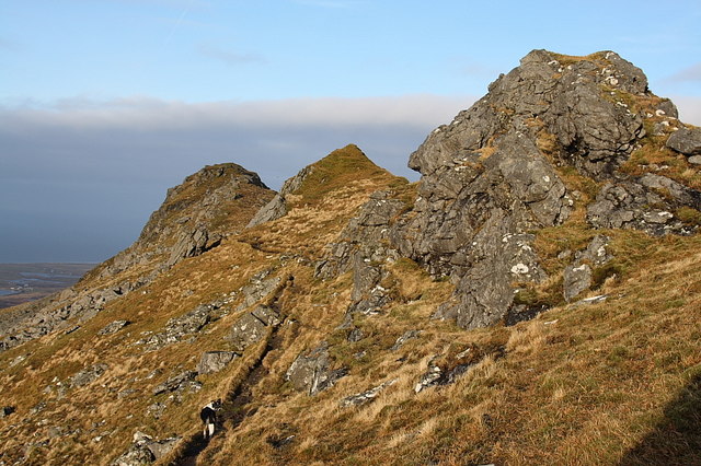
Beinn Mhor
Path below the summit ridge.
 Map © Crown Copyright")
TIP: Click the map for more Large scale mapping
- Grid Square
- NF8031, 17 images (more nearby 🔍)
- Photographer
- Rupert Fleetingly (more nearby)
- Date Taken
- Wednesday, 4 January, 2017 (more nearby)
- Submitted
- Wednesday, 11 January, 2017
- Subject Location
-
OSGB36:
 NF 8061 3140 [10m precision]
WGS84: 57:15.6768N 7:17.9652W - Camera Location
-
OSGB36: NF 8068 3125
- View Direction
- North-northwest (about 337 degrees)