2017
SZ7799 : Ella Nore - Barricade at entrance to Snowhill Creek
taken 7 years ago, near to West Wittering, West Sussex, England
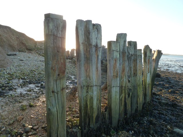
Ella Nore - Barricade at entrance to Snowhill Creek
The low sun is obscured behind one of the wooden stakes forming a barricade on the shoreline on the eastern side of the mouth of Snowhill Creek. What the purpose of this barricade is or was, I don't know, unless, like a groyne it was intended to protect the bank here.
See also SZ7799 : Wooden barricade near Ella Nore
See also SZ7799 : Wooden barricade near Ella Nore
Ella Nore
Ella Nore is a sand and shingle bank to the west of the village of West Wittering. It projects into the southernmost end of the Chichester Channel as it enters Stockers Lake, itself part of Chichester Harbour.
It is a short spit of land enclosing saltings, marsh and mud. The eastern tip of it is a nature conservation area where entry is not permitted so as to protect the nesting area of the numerous species of birds that thrive in this habitat.
The area is rich in wildlife with the mud providing rich pickings for sea and marshland birds such as gulls, ducks, geese and waders such as curlews; all of which can be heard and seen in this unspoilt location.
 Map © Crown Copyright")
TIP: Click the map for more Large scale mapping
- Grid Square
- SZ7799, 100 images (more nearby 🔍)
- Photographer
- Rob Farrow (more nearby)
- Date Taken
- Saturday, 28 January, 2017 (more nearby)
- Submitted
- Tuesday, 31 January, 2017
- Subject Location
-
OSGB36:
 SZ 7748 9941 [10m precision]
WGS84: 50:47.3455N 0:54.1308W - Camera Location
-
OSGB36: SZ 7748 9942
- View Direction
- Southwest (about 225 degrees)