2017
SU5918 : Motocross track on Peak Down (revised layout)
taken 7 years ago, near to Droxford, Hampshire, England
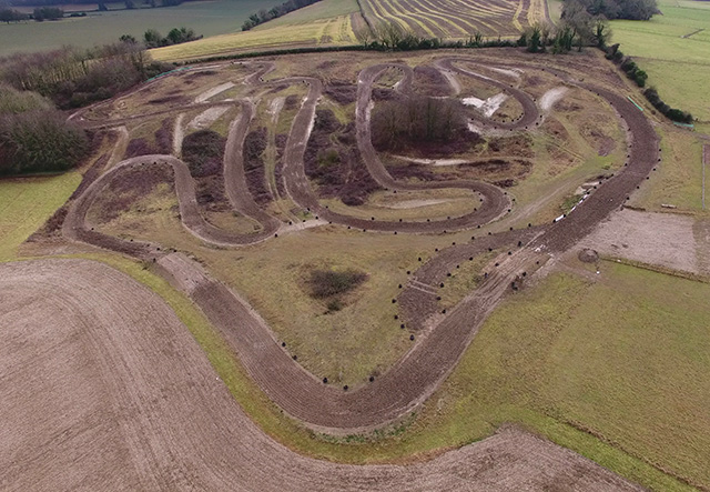
Motocross track on Peak Down (revised layout)
The old layout could be seen on Google Earth at time of photographing, and as a white track in this photo. The new layout is earthy coloured, and marked out by the tyres. Taken from a drone at height 55m above ground.
 Map © Crown Copyright")
TIP: Click the map for more Large scale mapping
- Grid Square
- SU5918, 22 images (more nearby 🔍)
- Photographer
- Peter Facey (more nearby)
- Date Taken
- Wednesday, 1 February, 2017 (more nearby)
- Submitted
- Wednesday, 1 February, 2017
- Subject Location
-
OSGB36:
 SU 5947 1882 [10m precision]
WGS84: 50:57.9444N 1:9.2698W - Camera Location
-
OSGB36: SU 5941 1901
- View Direction
- South-southeast (about 157 degrees)