2007
SS8140 : Remains of Redbrooks House
taken 17 years ago, 4 km ENE of Simonsbath, Somerset, England
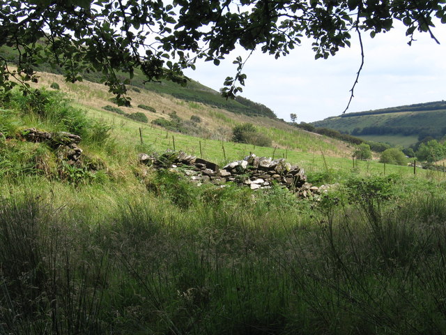
Remains of Redbrooks House
According to the brochure "Westermill Blue Walk", the origin of the name Redbrooks is unclear. Possibly it was named after farmer/owner R. Edbrook (17th Century) from Exford. Or after Redbrooks in Gloucestershire, because Sir John Poyntz, sheriff of Gloucestershire (16th Century) stayed here when he came hunting.
 Map © Crown Copyright")
TIP: Click the map for more Large scale mapping
- Grid Square
- SS8140, 8 images (more nearby 🔍)
- Photographer
- Arjen Bax (more nearby)
- Date Taken
- Wednesday, 1 August, 2007 (more nearby)
- Submitted
- Thursday, 16 August, 2007
- Subject Location
-
OSGB36:
 SS 8155 4049 [10m precision]
WGS84: 51:9.0824N 3:41.6971W - Camera Location
-
OSGB36: SS 8155 4049
- View Direction
- Southeast (about 135 degrees)