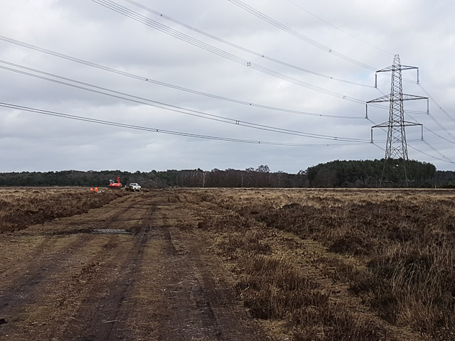
SU1917 : Ground investigation work by Structural Soils Ltd
taken 7 years ago, near to Hale, Hampshire, England
Ofgem agreed a set of price controls and incentives for the period from April 2013 to March 2021. The price controls and incentives included an allowance of £500 million to mitigate the visual impact of existing electricity infrastructure in nationally protected landscapes in Great Britain.
In 2015 National Grid Plc made money available for improving the appearance of their high voltage electricity lines and pylons in area of natural beauty under a Visual Impact Provision project. They consulted on which areas should receive this provision. Hale Purlieu in the northern part of the New Forest National Park was one area mentioned, and eventually chosen to be improved.
The chosen method was to put the electricity lines underground where they crossed the open forest, and to remove the pylons there.
In 2017 National Grid appointed Mott McDonald to carry out investigation of the ground in order to plan the best route for the underground cables. Mott McDonald in turn employed Structural Soils Ltd to carry out below-ground investigations.
 Map © Crown Copyright")
- Grid Square
- SU1917, 21 images (more nearby 🔍)
- Photographer
- Peter Facey (more nearby)
- Date Taken
- Thursday, 23 February, 2017 (more nearby)
- Submitted
- Thursday, 23 February, 2017
- Subject Location
-
OSGB36:
 SU 1987 1799 [10m precision]
WGS84: 50:57.6597N 1:43.1068W - Camera Location
-
OSGB36: SU 1978 1794
- View Direction
- East-northeast (about 67 degrees)