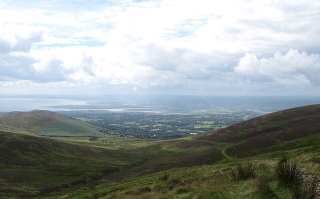
J1006 : The Castletown Estuary from the top of the Anaverna Trail
taken 9 years ago, near to Jenkinstown, Co Louth, Ireland
![Creative Commons Licence [Some Rights Reserved]](https://s1.geograph.org.uk/img/somerights20.gif)
|
· Find out How to reuse this image ·
Share:
|
|||||
| Start a discussion on J1006 | Suggest an update to this image | Contact the contributor | |||
Loading map... (JavaScript required)
- Grid Square
- J1006 (more nearby
 )
)
- Photographer
- Eric Jones (find more nearby)
- Date Taken
- Tuesday, 4 August, 2015 (more nearby)
- Submitted
- Sunday, 5 March, 2017
- Geographical Context
- Subject Location
-
Irish:
 J 103 064 [100m precision]
WGS84: 53:59.7523N 6:19.0682W - Camera Location
-
Irish: J 104 151
- View Direction
- SOUTH (about 180 degrees)
Image Type (about):
cross grid
This page has been viewed about 31 times.
View this location:
KML (Google Earth) ·
Google Maps ·
Bing Maps ·
Geograph Coverage Map ·
More Links for this image
·
Bing Maps ·
Geograph Coverage Map ·
More Links for this image