V5684 : View towards Cahersiveen and Valentia Island
taken 17 years ago, near to Kells, Co Kerry, Ireland
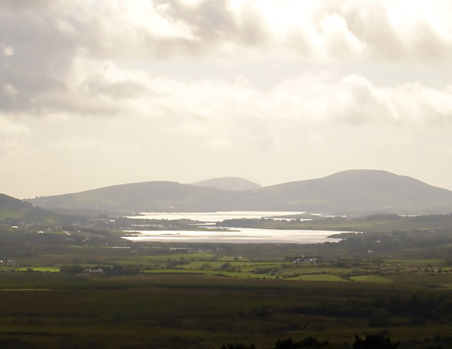
View towards Cahersiveen and Valentia Island
The river Ferta forms an estuary from V4981, with Cahersiveen at the narrowing. Beyond that is Valentia Island.
![Creative Commons Licence [Some Rights Reserved]](https://s1.geograph.org.uk/img/somerights20.gif)
|
· Find out How to reuse this image ·
Share:
|
|||||
| Start a discussion on V5684 | Suggest an update to this image | Contact the contributor | |||
Loading map... (JavaScript required)
- Grid Square
- V5684, 2 images (more nearby
 )
)
- Photographer
- Linda Bailey (find more nearby)
- Date Taken
- Sunday, 12 August, 2007 (more nearby)
- Submitted
- Monday, 20 August, 2007
- Category
- View > View (more nearby)
- Subject Location
-
Irish:
 V 566 843 [100m precision]
WGS84: 51:59.5644N 10:5.3058W - Camera Location
-
Irish: V 566 843
- View Direction
- West-southwest (about 247 degrees)
Image classification(about):
Supplemental image
This page has been viewed about 389 times.
View this location:
KML (Google Earth) ·
Google Maps ·
Bing Maps ·
Geograph Coverage Map ·
More Links for this image
·
Bing Maps ·
Geograph Coverage Map ·
More Links for this image