2007
SS9147 : Triangulation point at the top of Selworthy Beacon
taken 17 years ago, near to Selworthy, Somerset, England
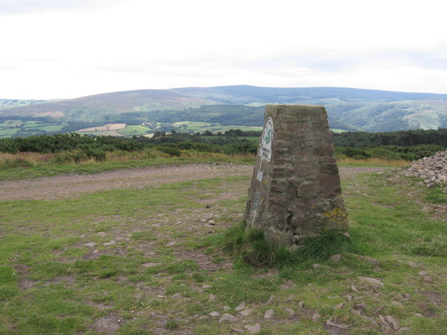
Triangulation point at the top of Selworthy Beacon
The plaque on the left side of the pillar shows the National Trust logo.
The highest top at the horizon, just left of the pillar, is the highest point of Exmoor: Dunkery Beacon in SS8941.
The highest top at the horizon, just left of the pillar, is the highest point of Exmoor: Dunkery Beacon in SS8941.
 Map © Crown Copyright")
TIP: Click the map for more Large scale mapping
- Grid Square
- SS9147, 58 images (more nearby 🔍)
- Photographer
- Arjen Bax (more nearby)
- Date Taken
- Friday, 3 August, 2007 (more nearby)
- Submitted
- Tuesday, 21 August, 2007
- Subject Location
-
OSGB36:
 SS 91885 47986 [1m precision]
WGS84: 51:13.2480N 3:32.9702W - Camera Location
-
OSGB36: SS 91885 47986
- View Direction
- South-southwest (about 202 degrees)