J3675 : Road signs, Victoria Park subway, Belfast (April 2017)
taken 7 years ago, 3 km from Belfast, Co Antrim, Northern Ireland
A park of some 60 acres, built on reclaimed land in 1906, between the industrial part of Belfast Harbour Estate and the Sydenham bypass, replacing an earlier pleasure park on Dargan Island (now Queens Island). There is a large lake with two islands. The park is partly enclosed by an embankment on the northern and western sides.
It attracts a considerable number of ducks and greylag geese. On one of the flight paths to the George Best Belfast City Airport low flying aircraft are one of the attractions.
Part of the park is included in the Connswater Greenway project LinkProposals in Victoria Park will protect and enhance its environmental and amenity value. Proposals include a new bridge into Airport Road, lighting, improved and new paths, an observation point, new toilet block, interpretative signage and a trim trail.
Most of the park is level making it suitable for those with impaired mobility. There is a car park and public toilets.
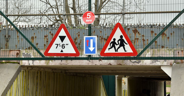
A collection of photographs showing road signs and marking in their context. It exists as a matter of record only, has no connection with any official body and does not claim to be a definitive or legally-binding guide. The official version is the Highway Code for Northern Ireland.
No breach of Crown copyright intended. I believe that my submissions are in accordance with the terms of the Open Government Licence for public sector information Link
![Creative Commons Licence [Some Rights Reserved]](https://s1.geograph.org.uk/img/somerights20.gif)
|
· Find out How to reuse this image ·
Share:
|
|||||
| Start a discussion on J3675 | Suggest an update to this image | Contact the contributor | |||
- Grid Square
- J3675, 583 images (more nearby
 )
)
- Photographer
- Albert Bridge (find more nearby)
- Date Taken
- Monday, 3 April, 2017 (more nearby)
- Submitted
- Monday, 3 April, 2017
- Geographical Context
- Place (from Tags)
- Subject Location
-
Irish:
 J 366 750 [100m precision]
WGS84: 54:36.3009N 5:53.1900W - Camera Location
-
Irish: J 366 750
- View Direction
- Northwest (about 315 degrees)
Other Tags