2017
NH6242 : Path around Craig Dunain
taken 7 years ago, near to Dochgarroch, Highland, Scotland
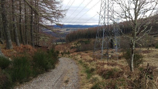
Path around Craig Dunain
Bit of a slog but great view from the path in a clearing in the woods.
 Map © Crown Copyright")
TIP: Click the map for more Large scale mapping
- Grid Square
- NH6242, 13 images (more nearby 🔍)
- Photographer
- Alasdair MacNeill (more nearby)
- Date Taken
- Sunday, 19 February, 2017 (more nearby)
- Submitted
- Saturday, 22 April, 2017
- Subject Location
-
OSGB36:
 NH 6228 4267 [10m precision]
WGS84: 57:27.2018N 4:17.8139W - Camera Location
-
OSGB36: NH 6213 4293
- View Direction
- South-southeast (about 157 degrees)