2007
SN7671 : Nant Ffin from edge of Coed Bwlchgwallter
taken 17 years ago, 3 km from Pont-Rhyd-y-Groes, Ceredigion/Sir Ceredigion, Wales
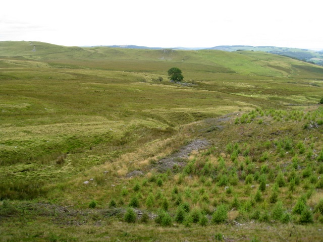
Nant Ffin from edge of Coed Bwlchgwallter
Natural regeneration forestry and a single tree next to a derelict cottage in middle of a large area of boggy ground in the distance.
 Map © Crown Copyright")
TIP: Click the map for more Large scale mapping
- Grid Square
- SN7671, 14 images (more nearby 🔍)
- Photographer
- Jon Moorby (more nearby)
- Date Taken
- Monday, 27 August, 2007 (more nearby)
- Submitted
- Monday, 27 August, 2007
- Subject Location
-
OSGB36:
 SN 764 712 [100m precision]
WGS84: 52:19.5350N 3:48.8241W - Camera Location
-
OSGB36: SN 765 712
- View Direction
- WEST (about 270 degrees)