2017
NS3974 : Dumbarton Castle: the Spur Battery
taken 7 years ago, near to Dumbarton, West Dunbartonshire, Scotland
This is 1 of 57 images, with title starting with Dumbarton in this square
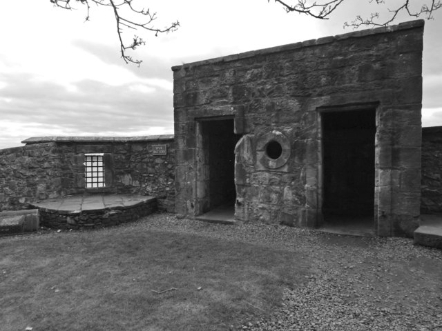
Dumbarton Castle: the Spur Battery
The structure on the right was a latrine, and (because of that, I presume) it projects slightly from the curtain wall of Dumbarton Rock, as is made clear in NS3974 : Dumbarton Castle: area west of the Governor's House, where this area is shown near the upper left corner of the photograph. The opening on the left, with a grille, can also be seen in that picture.
Dumbarton Rock and Castle :: NS4074
The Rock is a volcanic plug, and it has a long history as a fortified site. For further information, see the Geograph article "Dumbarton Rock and Castle": Link
 Map © Crown Copyright")
TIP: Click the map for more Large scale mapping
- Grid Square
- NS3974, 267 images (more nearby 🔍)
- Photographer
- Lairich Rig (more nearby)
- Date Taken
- Sunday, 23 April, 2017 (more nearby)
- Submitted
- Thursday, 18 May, 2017
- Subject Location
-
OSGB36:
 NS 3998 7439 [10m precision]
WGS84: 55:56.1512N 4:33.7994W - Camera Location
-
OSGB36: NS 3997 7440
- View Direction
- Southeast (about 135 degrees)