2017
SE6597 : Monket House Bank and old quarry
taken 7 years ago, near to Church Houses, North Yorkshire, England
This is 1 of 4 images, with title starting with Monket House in this square
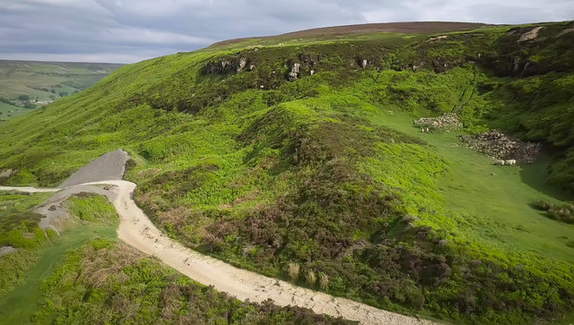
Monket House Bank and old quarry
The bank here is exceptionally steep and rough - a challenge however you go up or down.
Though not sealed, it is a quite well used green lane route over to Bransdale or at a crossroads on top via Rudland Rigg south to Gillamoor or north to Ingleby.
Though not sealed, it is a quite well used green lane route over to Bransdale or at a crossroads on top via Rudland Rigg south to Gillamoor or north to Ingleby.
 Map © Crown Copyright")
TIP: Click the map for more Large scale mapping
- Grid Square
- SE6597, 38 images (more nearby 🔍)
- Photographer
- Colin Grice (more nearby)
- Date Taken
- Sunday, 28 May, 2017 (more nearby)
- Submitted
- Monday, 29 May, 2017
- Subject Location
-
OSGB36:
 SE 6555 9708 [10m precision]
WGS84: 54:21.9019N 0:59.5599W - Camera Location
-
OSGB36: SE 6543 9715
- View Direction
- East-southeast (about 112 degrees)