2017
NH1879 : Moorland above Braemore
taken 7 years ago, near to Braemore, Highland, Scotland
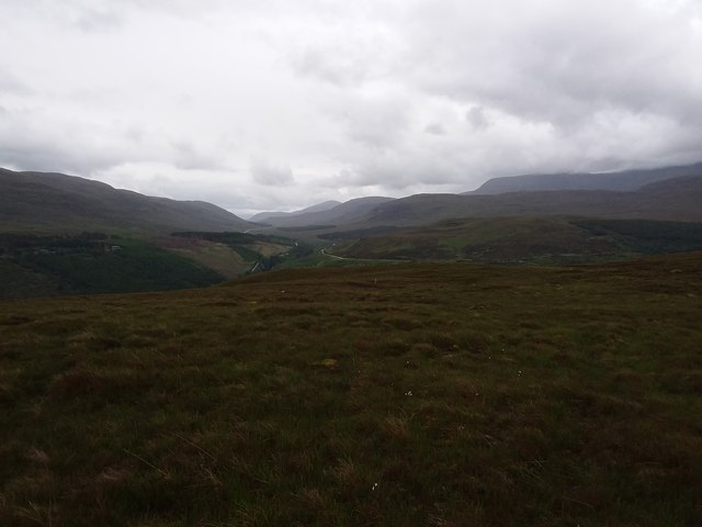
Moorland above Braemore
A heavy shower is about to hit but the A832 and A835 roads can just be seen. Corrieshalloch Gorge is between them.
 Map © Crown Copyright")
TIP: Click the map for more Large scale mapping
- Grid Square
- NH1879 (more nearby 🔍)
- Photographer
- Andrew Spenceley (more nearby)
- Date Taken
- Monday, 5 June, 2017 (more nearby)
- Submitted
- Friday, 9 June, 2017
- Subject Location
-
OSGB36:
 NH 186 791 [100m precision]
WGS84: 57:45.9305N 5:3.0410W - Camera Location
-
OSGB36: NH 180 798
- View Direction
- Southeast (about 135 degrees)