J4669 : Landscaping, Comber bypass (June 2017)
taken 7 years ago, near to Comber, Co Down, Northern Ireland
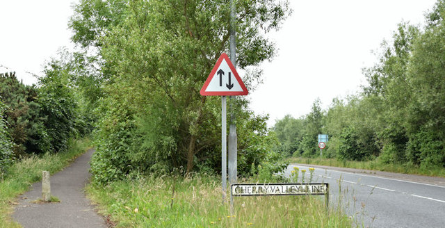
Landscaping, Comber bypass (June 2017)
See J4669 : The Comber bypass (5) (May 2010). The Newtownards end of the bypass showing a significant growth in the landscaping. The road is called the Cherryvalley Line following the name of the local townland.
The Comber bypass
Phase 1 of the Comber bypass opened in the 60s. Phase 2 opened in 2003. Both are built on the line of the old Belfast-Donaghadee railway. It connects the Belfast road to the roads to Killyleagh/Downpatrick and Newtownards.
![Creative Commons Licence [Some Rights Reserved]](https://s1.geograph.org.uk/img/somerights20.gif)
|
· Find out How to reuse this image ·
Share:
|
|||||
| Start a discussion on J4669 | Suggest an update to this image | Contact the contributor | |||
Loading map... (JavaScript required)
- Grid Square
- J4669, 129 images (more nearby
 )
)
- Photographer
- Albert Bridge (find more nearby)
- Date Taken
- Wednesday, 21 June, 2017 (more nearby)
- Submitted
- Wednesday, 21 June, 2017
- Geographical Context
- Place (from Tags)
- Primary Subject of Photo
- Subject Location
-
Irish:
 J 469 693 [100m precision]
WGS84: 54:33.0472N 5:43.8150W - Camera Location
-
Irish: J 469 693
- View Direction
- Southwest (about 225 degrees)
Other Tags
This page has been viewed about 65 times.
View this location:
KML (Google Earth) ·
Google Maps ·
Bing Maps ·
Geograph Coverage Map ·
More Links for this image
·
Bing Maps ·
Geograph Coverage Map ·
More Links for this image