2007
NM8618 : Hill Track above Corrylorn Farm
taken 17 years ago, 5 km SE of Raera, Argyll And Bute, Scotland
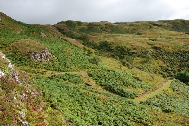
Hill Track above Corrylorn Farm
This picture shows the last part of the track that climbs the hillside behind Corrylorn Farm. The track comes to an end just after it passes between the rocks to the left of the picture. Elevation at this point is around 230m.
 Map © Crown Copyright")
TIP: Click the map for more Large scale mapping
- Grid Square
- NM8618, 4 images (more nearby 🔍)
- Photographer
- Colin Chambers (more nearby)
- Date Taken
- Friday, 31 August, 2007 (more nearby)
- Submitted
- Sunday, 2 September, 2007
- Subject Location
-
OSGB36:
 NM 867 181 [100m precision]
WGS84: 56:18.4309N 5:26.9832W - Camera Location
-
OSGB36: NM 865 180
- View Direction
- East-northeast (about 67 degrees)