2017
TG3217 : Dydall's Drainage Mill on the River Bure
taken 7 years ago, near to Horning, Norfolk, England
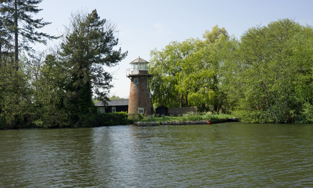
Dydall's Drainage Mill on the River Bure
Known by other names, but this is the name on the Ordnance Survey map.
 Map © Crown Copyright")
TIP: Click the map for more Large scale mapping
- Grid Square
- TG3217, 18 images (more nearby 🔍)
- Photographer
- Phil Gaskin (more nearby)
- Date Taken
- Thursday, 11 May, 2017 (more nearby)
- Submitted
- Tuesday, 11 July, 2017
- Subject Location
-
OSGB36:
 TG 3257 1713 [10m precision]
WGS84: 52:42.1109N 1:26.4499E - Camera Location
-
OSGB36: TG 3259 1711
- View Direction
- Northwest (about 315 degrees)