J4082 : Belfast Lough, Channel Marker Number 5
taken 7 years ago, 3 km from Craigavad, Co Down, Northern Ireland
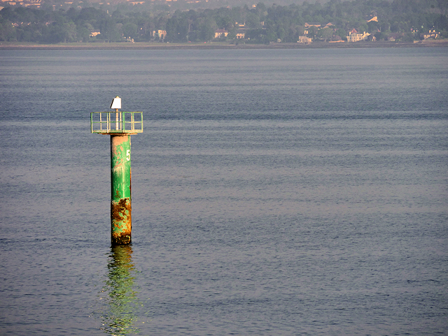
Belfast Lough, Channel Marker Number 5
When entering or leaving Belfast Harbour, ships must follow the relatively narrow, dredged Victoria Channel which has sandbank on either side. This channel is indicated by a series of numbered marker buoys and posts; starboard (green) markers carry odd numbers and port (red) markers carry even numbers. This is starboard (green) marker post number 5; its charted position is at position 54°40.5N, 005°49.8W ±50m
(Link Visit My Harbour).
(Link
![Creative Commons Licence [Some Rights Reserved]](https://s1.geograph.org.uk/img/somerights20.gif)
|
· Find out How to reuse this image ·
Share:
|
|||||
| Start a discussion on J4082 | Suggest an update to this image | Contact the contributor | |||
Loading map... (JavaScript required)
- Grid Square
- J4082, 5 images (more nearby
 )
)
- Photographer
- David Dixon (find more nearby)
- Date Taken
- Friday, 26 May, 2017 (more nearby)
- Submitted
- Sunday, 23 July, 2017
- Geographical Context
- Camera (from Tags)
- Subject Location
-
Irish:
 J 400 829 [100m precision]
WGS84: 54:40.4998N 5:49.8006W - Camera Location
-
Irish: J 402 829
- View Direction
- WEST (about 270 degrees)
Other Tags
Image Type (about):
close look
This page has been viewed about 55 times.
View this location:
KML (Google Earth) ·
Google Maps ·
Bing Maps ·
Geograph Coverage Map ·
More Links for this image