2017
NZ6605 : Derelict Pumping Station
taken 7 years ago, near to Westerdale, North Yorkshire, England
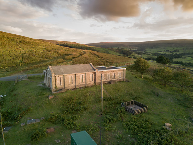
Derelict Pumping Station
Still owned by Yorkshire Water, and they have equipment in the enclosure which needs monitoring by an employee visiting every few days.
The small darker enclosure is the Environment Agency's official rain gauge.
Plans have recently been submitted to convert into a substantial house.
The building is more or less a large barn with nothing left inside.
The small darker enclosure is the Environment Agency's official rain gauge.
Plans have recently been submitted to convert into a substantial house.
The building is more or less a large barn with nothing left inside.
 Map © Crown Copyright")
TIP: Click the map for more Large scale mapping
- Grid Square
- NZ6605, 113 images (more nearby 🔍)
- Photographer
- Colin Grice (more nearby)
- Date Taken
- Monday, 31 July, 2017 (more nearby)
- Submitted
- Monday, 31 July, 2017
- Subject Location
-
OSGB36:
 NZ 6642 0523 [10m precision]
WGS84: 54:26.2891N 0:58.6475W - Camera Location
-
OSGB36: NZ 6646 0527
- View Direction
- Southwest (about 225 degrees)