2007
SY5398 : North Poorton: Mount Pleasant
taken 17 years ago, near to Hooke, Dorset, England
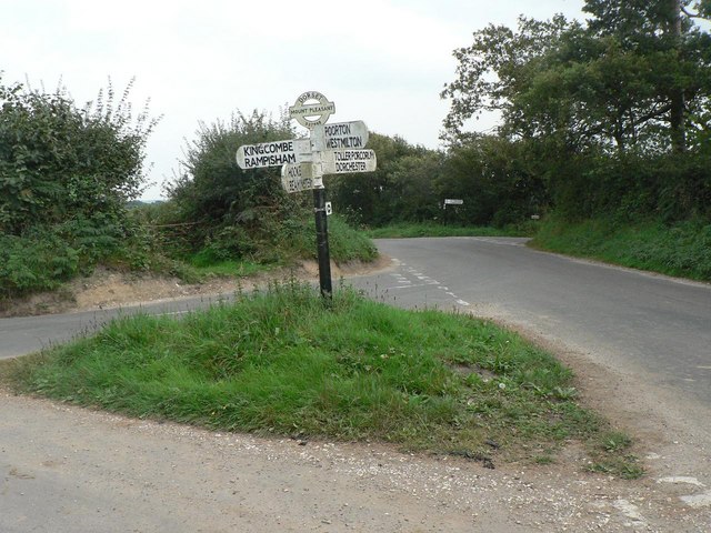
North Poorton: Mount Pleasant
The road that goes from behind the camera straight through the picture forms the boundary between the parishes of North Poorton and Powerstock.
The old Dorset guide post is a rare survival, with location and grid reference on the 'underground style' piece. For a close-up of the finial, see SY5398 : North Poorton: finger-post detail.
The old Dorset guide post is a rare survival, with location and grid reference on the 'underground style' piece. For a close-up of the finial, see SY5398 : North Poorton: finger-post detail.
 Map © Crown Copyright")
TIP: Click the map for more Large scale mapping
- Grid Square
- SY5398, 26 images (more nearby 🔍)
- Photographer
- Chris Downer (more nearby)
- Date Taken
- Sunday, 9 September, 2007 (more nearby)
- Submitted
- Sunday, 9 September, 2007
- Subject Location
-
OSGB36:
 SY 537 988 [100m precision]
WGS84: 50:47.2202N 2:39.4736W - Camera Location
-
OSGB36: SY 536 988
- View Direction
- East-southeast (about 112 degrees)