H2344 : Enniskillen Erne Bridge (detail)
taken 7 years ago, near to Enniskillen, Co Fermanagh, Northern Ireland
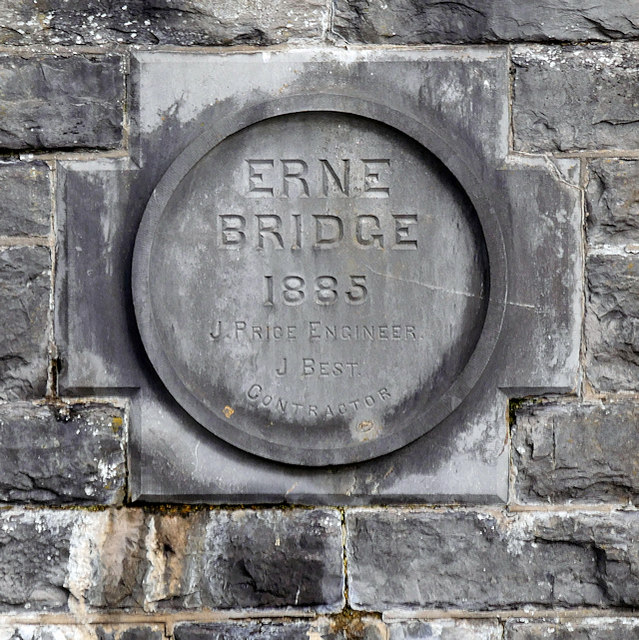
Enniskillen Erne Bridge (detail)
A closer look at H2344 : Erne Bridge, Enniskillen.
The River Erne is the second-longest river in Ulster. It rises on the east shoulder of Slieve Glah mountain and flows 80 miles through Lough Gowna, Lough Oughter and Upper and Lower Lough Erne, County Fermanagh, to the sea at Ballyshannon.
The town of Enniskillen is mostly situated on an island in the river, between Upper and Lower Lough Erne. Before 1950, the only access to the town was by two bridges, the present East Bridge (built in 1892) and the West Bridge, or Erne Bridge, which was built in 1885.
![Creative Commons Licence [Some Rights Reserved]](https://s1.geograph.org.uk/img/somerights20.gif)
|
· Find out How to reuse this image ·
Share:
|
|||||
| Start a discussion on H2344 | Suggest an update to this image | Contact the contributor | |||
Loading map... (JavaScript required)
- Grid Square
- H2344, 589 images (more nearby
 )
)
- Photographer
- David Dixon (find more nearby)
- Date Taken
- Monday, 25 September, 2017 (more nearby)
- Submitted
- Tuesday, 3 October, 2017
- Geographical Context
- Camera (from Tags)
- Image Buckets ?
- Subject Location
-
Irish:
 H 231 443 [100m precision]
WGS84: 54:20.8296N 7:38.7134W - Camera Location
-
Irish: H 231 443
- View Direction
- North-northeast (about 22 degrees)
Other Tags
Image Type (about):
close look
This page has been viewed about 58 times.
View this location:
KML (Google Earth) ·
Google Maps ·
Bing Maps ·
Geograph Coverage Map ·
More Links for this image
·
Bing Maps ·
Geograph Coverage Map ·
More Links for this image