2007
TQ8071 : Kingsnorth Power Station
taken 17 years ago, 3 km from Hoo st Werburgh, Medway, England
This is 1 of 5 images, with title Kingsnorth Power Station in this square
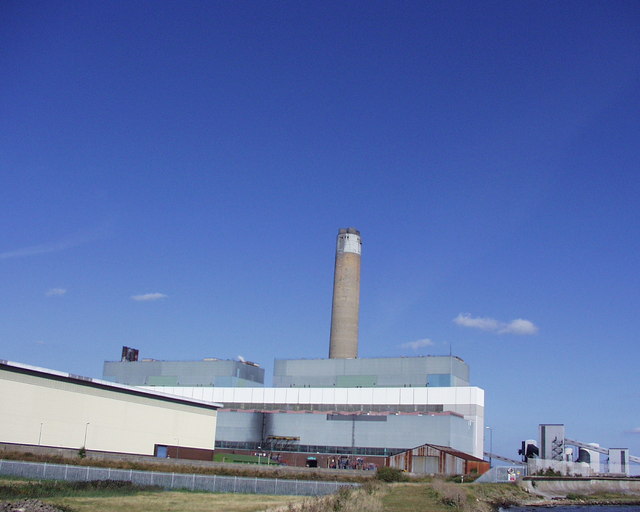
Kingsnorth Power Station
Kingsnorth power station chimney stands at a respectable 650ft tall
and was completed in 1970
The power station burns both oil and coal which is delivered by ship from the River Medway
and was completed in 1970
The power station burns both oil and coal which is delivered by ship from the River Medway
 Map © Crown Copyright")
TIP: Click the map for more Large scale mapping
- Grid Square
- TQ8071, 54 images (more nearby 🔍)
- Photographer
- Daniel Gregson (more nearby)
- Date Taken
- Sunday, 16 September, 2007 (more nearby)
- Submitted
- Sunday, 16 September, 2007
- Subject Location
-
OSGB36:
 TQ 808 718 [100m precision]
WGS84: 51:25.0252N 0:35.9667E - Camera Location
-
OSGB36: TQ 805 717
- View Direction
- East-northeast (about 67 degrees)