2017
TQ2670 : Northern confluence of River Wandle & Pickle Ditch
taken 6 years ago, near to Merton, England
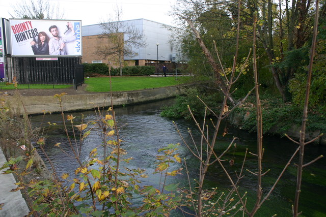
Northern confluence of River Wandle & Pickle Ditch
The wider watercourse in the foreground is the Wandle and the narrower stream the Pickle Ditch (or just Pickle). The latter follows the previous course of the Wandle whose present course it rejoins just upstream of what is now the Merton Abbey Mills craft village. It seems that the Wandle was so diverted in the C18 to power the various mills that had been established in the area.
 Map © Crown Copyright")
TIP: Click the map for more Large scale mapping
- Grid Square
- TQ2670, 176 images (more nearby 🔍)
- Photographer
- David Kemp (more nearby)
- Date Taken
- Wednesday, 1 November, 2017 (more nearby)
- Submitted
- Wednesday, 22 November, 2017
- Subject Location
-
OSGB36:
 TQ 2661 7016 [10m precision]
WGS84: 51:24.9797N 0:10.8414W - Camera Location
-
OSGB36: TQ 2659 7015
- View Direction
- East-northeast (about 67 degrees)