2015
SE3914 : Havercroft greenway
taken 8 years ago, near to Ryhill, Wakefield, England
This is 1 of 2 images, with title starting with Havercroft in this square
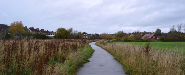
Havercroft greenway
This short path runs alongside a beck between Brooklands Crescent and East Street at the eastern fringe of the village.
 Map © Crown Copyright")
TIP: Click the map for more Large scale mapping
- Grid Square
- SE3914, 27 images (more nearby 🔍)
- Photographer
- Bobby Clegg (more nearby)
- Date Taken
- Monday, 9 November, 2015 (more nearby)
- Submitted
- Monday, 27 November, 2017
- Subject Location
-
OSGB36:
 SE 3972 1438 [10m precision]
WGS84: 53:37.4674N 1:24.0556W - Camera Location
-
OSGB36: SE 3974 1426
- View Direction
- NORTH (about 0 degrees)