2017
SP4678 : Fennis Field Arm, leading to Brinklow Marina
taken 7 years ago, near to Easenhall, Warwickshire, England
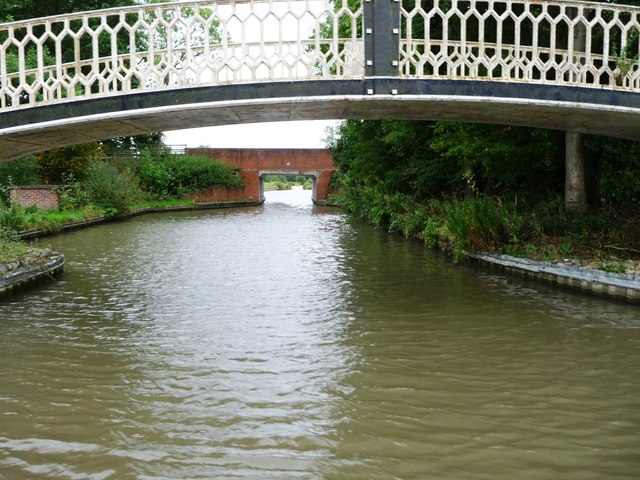
Fennis Field Arm, leading to Brinklow Marina
Once this was the through route of the Oxford Canal. Straightening the North Oxford in the 1820s created a 'side loop' here, of which this is the northern end. This section remained navigable longer than the rest of the loop, and became known as the Fennis Field Arm. Now it leads to a new marina.
 Map © Crown Copyright")
TIP: Click the map for more Large scale mapping
- Grid Square
- SP4678, 88 images (more nearby 🔍)
- Photographer
- Christine Johnstone (more nearby)
- Date Taken
- Thursday, 7 September, 2017 (more nearby)
- Submitted
- Tuesday, 28 November, 2017
- Subject Location
-
OSGB36:
 SP 4622 7850 [10m precision]
WGS84: 52:24.1540N 1:19.3240W - Camera Location
-
OSGB36: SP 4623 7852
- View Direction
- South-southwest (about 202 degrees)