2017
SJ4382 : Speke and Liverpool John Lennon Airport
taken 6 years ago, near to Liverpool John Lennon Airport, Liverpool, England
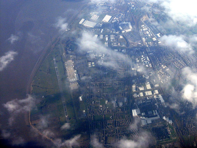
Speke and Liverpool John Lennon Airport
Looking west from over the A56/M56 J11 near Daresbury.
Liverpool Airport
Liverpool John Lennon Airport (IATA: LPL,) is an international airport serving North West England. On the outbreak of World War II the airport was operated by the RAF and known as RAF Speke. The airport is within the City of Liverpool on the banks of the estuary of the River Mersey some 6.5 nautical miles south east of the city centre. The airport is named after Liverpudlian musician John Lennon of The Beatles. Scheduled domestic and European services are operated from the airport. The airport has about 4 - 5 million passengers a year.
Wikipedia: Link
 Map © Crown Copyright")
TIP: Click the map for more Large scale mapping
- Grid Square
- SJ4382, 91 images (more nearby 🔍)
- Photographer
- M J Richardson (more nearby)
- Date Taken
- Thursday, 23 November, 2017 (more nearby)
- Submitted
- Tuesday, 28 November, 2017
- Subject Location
-
OSGB36:
 SJ 436 827 [100m precision]
WGS84: 53:20.2909N 2:50.9092W - Camera Location
-
OSGB36: SJ 579 821
- View Direction
- WEST (about 270 degrees)