2017
NT2438 : Bonnington farm
taken 6 years ago, near to Kings Muir, Scottish Borders, Scotland
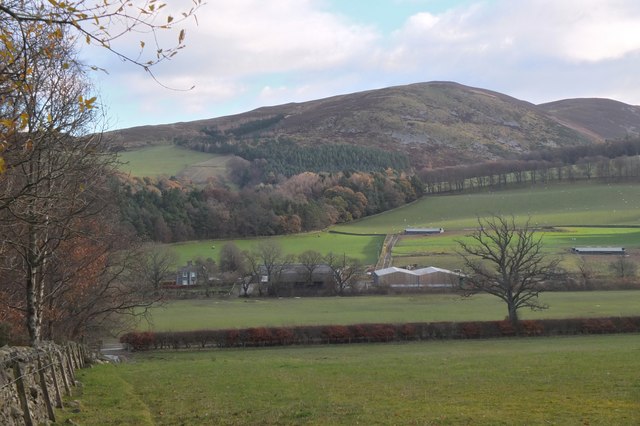
Bonnington farm
Seen across fields from the edge of Cademuir Forest with Craig Head and the Drove Road on the ridge above.
 Map © Crown Copyright")
TIP: Click the map for more Large scale mapping
- Grid Square
- NT2438, 182 images (more nearby 🔍)
- Photographer
- Jim Barton (more nearby)
- Date Taken
- Wednesday, 29 November, 2017 (more nearby)
- Submitted
- Wednesday, 29 November, 2017
- Subject Location
-
OSGB36:
 NT 2498 3826 [10m precision]
WGS84: 55:37.9256N 3:11.5876W - Camera Location
-
OSGB36: NT 2491 3826
- View Direction
- EAST (about 90 degrees)