2017
TA0724 : Old and new uses, New Holland Pier
taken 7 years ago, near to New Holland, North Lincolnshire, England
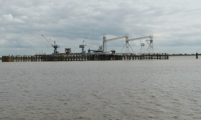
Old and new uses, New Holland Pier
The roofs of the station platform stations can be seen in the centre. TA0724 : New Holland Pier station, 1981 is a view the other way.
 Map © Crown Copyright")
TIP: Click the map for more Large scale mapping
- Grid Square
- TA0724, 74 images (more nearby 🔍)
- Photographer
- Christine Johnstone (more nearby)
- Date Taken
- Thursday, 24 August, 2017 (more nearby)
- Submitted
- Tuesday, 5 December, 2017
- Subject Location
-
OSGB36:
 TA 0793 2481 [10m precision]
WGS84: 53:42.5139N 0:21.9791W - Camera Location
-
OSGB36: TA 0788 2497
- View Direction
- South-southeast (about 157 degrees)