2017
SH5186 : Ynys Moelfre
taken 6 years ago, near to Moelfre, Isle of Anglesey/Sir Ynys Mon, Wales
This is 1 of 5 images, with title Ynys Moelfre in this square
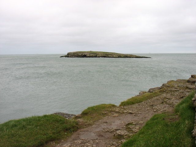
Ynys Moelfre
Seen from near the Lifeboat Station.
It is interesting that this island has the same profile as Puffin Island, albeit on a smaller scale.
It is interesting that this island has the same profile as Puffin Island, albeit on a smaller scale.
Moelfre
Moelfre is a village and community on the north east coast of Isle of Anglesey, and on the Anglesey Coastal Path. The meaning of the Welsh language word Moelfre translated in English is 'bald or barren hill', which describes the land behind the village, as seen from the sea.
 Map © Crown Copyright")
TIP: Click the map for more Large scale mapping
- Grid Square
- SH5186, 301 images (more nearby 🔍)
- Photographer
- David Purchase (more nearby)
- Date Taken
- Sunday, 24 December, 2017 (more nearby)
- Submitted
- Thursday, 28 December, 2017
- Subject Location
-
OSGB36:
 SH 5190 8688 [10m precision]
WGS84: 53:21.4796N 4:13.6092W - Camera Location
-
OSGB36: SH 5165 8665
- View Direction
- Northeast (about 45 degrees)