2017
SK2674 : The Curbar Gap
taken 6 years ago, near to Curbar, Derbyshire, England
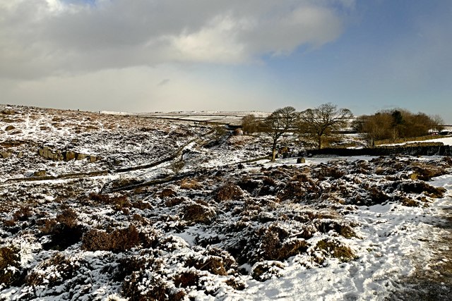
The Curbar Gap
This gap is between two gritstone edges, viewed here from Baslow Edge and looking towards Curbar Edge. This is very popular walking territory, especially on a sunny day after overnight snow during the Christmas holiday week.
 Map © Crown Copyright")
TIP: Click the map for more Large scale mapping
- Grid Square
- SK2674, 97 images (more nearby 🔍)
- Photographer
- Graham Hogg (more nearby)
- Date Taken
- Thursday, 28 December, 2017 (more nearby)
- Submitted
- Thursday, 28 December, 2017
- Subject Location
-
OSGB36:
 SK 2606 7469 [10m precision]
WGS84: 53:16.1140N 1:36.6435W - Camera Location
-
OSGB36: SK 2602 7459
- View Direction
- North-northeast (about 22 degrees)