2018
SN1745 : Liable to Flooding
taken 6 years ago, near to Bridgend, Ceredigion/Sir Ceredigion, Wales
This is 1 of 2 images, with title Liable to Flooding in this square
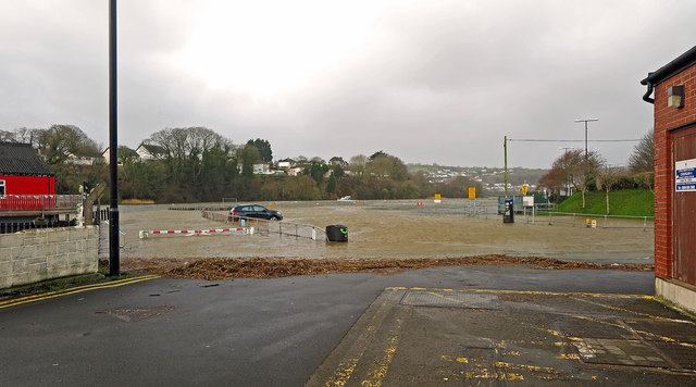
Liable to Flooding
Lower Mwldan car park, Cardigan - high spring tide.
 Map © Crown Copyright")
TIP: Click the map for more Large scale mapping
- Grid Square
- SN1745, 433 images (more nearby 🔍)
- Photographer
- Dylan Moore (more nearby)
- Date Taken
- Thursday, 4 January, 2018 (more nearby)
- Submitted
- Thursday, 4 January, 2018
- Subject Location
-
OSGB36:
 SN 17542 45970 [1m precision]
WGS84: 52:4.9162N 4:39.8528W - Camera Location
-
OSGB36: SN 17606 45976
- View Direction
- WEST (about 270 degrees)