H0258 : Lower Lough Erne, Rough Islands and White Cairn
taken 7 years ago, 9 km E of Belleek, Co Fermanagh, Northern Ireland
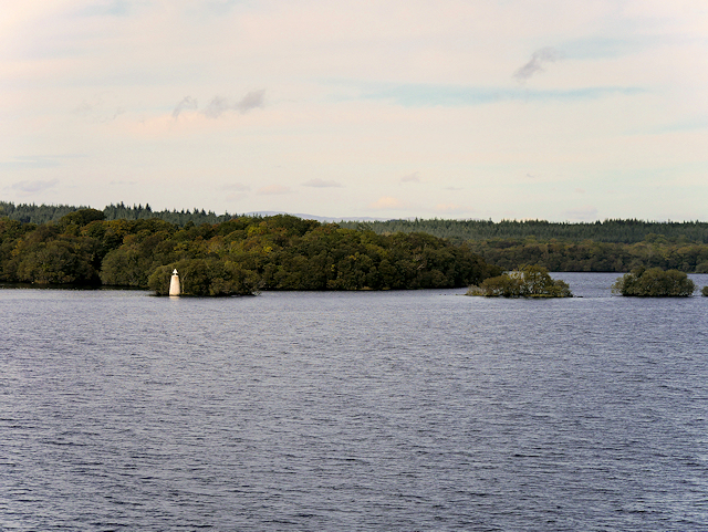
Lower Lough Erne, Rough Islands and White Cairn
Lough Erne (Loch Éirne) is the name of two connected freshwater lakes in County Fermanagh. It is the second-biggest lake system in Northern Ireland and Ulster, and the fourth biggest in Ireland. The lakes are widened sections of the River Erne, which flows north and then curves west into the Atlantic. The smaller southern lake is called the Upper Lough as it is higher up the river whilst the bigger northern lake is called the Lower Lough or Broad Lough. The town of Enniskillen lies on the short stretch of river between the lakes.
During the Second World War, Sunderland flying boats based at RAF Castle Archdale, on the eastern shore of Lower Lough Erne, patrolled the North Atlantic to protect shipping convoys against German U-boats. A secret agreement with the government of Ireland allowed aircraft to fly from Lough Erne to the Atlantic along the Donegal Corridor, providing vital air cover from one of the most westerly RAF bases in the United Kingdom (see G9358 : The Donegal Corridor). Perhaps this large round marker was used to aid their navigation?
During the Second World War, Sunderland flying boats based at RAF Castle Archdale, on the eastern shore of Lower Lough Erne, patrolled the North Atlantic to protect shipping convoys against German U-boats. A secret agreement with the government of Ireland allowed aircraft to fly from Lough Erne to the Atlantic along the Donegal Corridor, providing vital air cover from one of the most westerly RAF bases in the United Kingdom (see G9358 : The Donegal Corridor). Perhaps this large round marker was used to aid their navigation?
![Creative Commons Licence [Some Rights Reserved]](https://s1.geograph.org.uk/img/somerights20.gif)
|
· Find out How to reuse this image ·
Share:
|
|||||
| Start a discussion on H0258 | Suggest an update to this image | Contact the contributor | |||
Loading map... (JavaScript required)
- Grid Square
- H0258, 3 images (more nearby
 )
)
- Photographer
- David Dixon (find more nearby)
- Date Taken
- Monday, 25 September, 2017 (more nearby)
- Submitted
- Monday, 15 January, 2018
- Geographical Context
- Subject Location
-
Irish:
 H 028 586 [100m precision]
WGS84: 54:28.5952N 7:57.3700W - Camera Location
-
Irish: H 029 582
- View Direction
- NORTH (about 0 degrees)
Other Tags
This page has been viewed about 146 times.
View this location:
KML (Google Earth) ·
Google Maps ·
Bing Maps ·
Geograph Coverage Map ·
More Links for this image
·
Bing Maps ·
Geograph Coverage Map ·
More Links for this image