2017
SD8065 : Benchmark beside B6480 below Giggleswick Scar
taken 7 years ago, near to Stackhouse, North Yorkshire, England
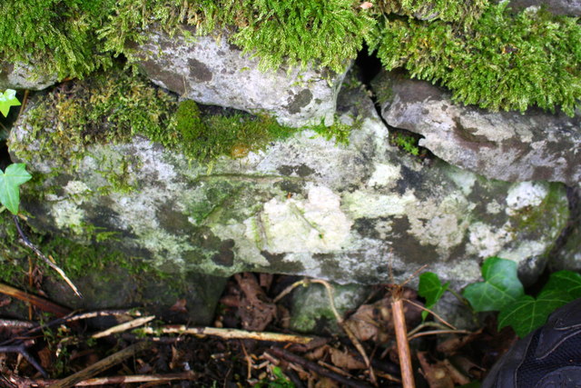
Benchmark beside B6480 below Giggleswick Scar
Ordnance Survey cut mark benchmark described on the Bench Mark Database at Link
 Map © Crown Copyright")
TIP: Click the map for more Large scale mapping
- Grid Square
- SD8065, 42 images (more nearby 🔍)
- Photographer
- Roger Templeman (more nearby)
- Date Taken
- Wednesday, 16 August, 2017 (more nearby)
- Submitted
- Tuesday, 16 January, 2018
- Subject Location
-
OSGB36:
 SD 8006 6565 [10m precision]
WGS84: 54:5.1823N 2:18.3788W - Camera Location
-
OSGB36: SD 8006 6565
- View Direction
- Northeast (about 45 degrees)