2018
NS3875 : Castle Hill: view down the western side
taken 6 years ago, near to Dumbarton, West Dunbartonshire, Scotland
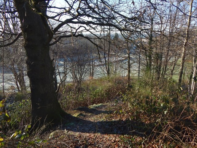
Castle Hill: view down the western side
This is a view from the top of the knoll that gives the Castlehill area of Dumbarton its name. The flat, pale-green area below is the NS3875 : Cunninghame Graham Memorial Park, covered in frost.
The rectangular feature that can be seen directly ahead, 100 metres away, in the present picture is a football pitch in an enclosure; in the picture just linked, it can also be seen in front of the left-hand side of the large building in the background (which is NS3875 : Our Lady and St Patrick's High School).
There is a path of sorts down this side of the knoll; see NS3875 : Castle Hill: view up the western side.
Castle Hill and Arthur's Seat
There are two small wooded knolls in the NS3875 : Cunninghame Graham Memorial Park, to the west of Castlehill Road in Dumbarton. The first-edition OS map, surveyed in 1860, calls the smaller knoll Arthur's Seat (NS38407590), and the larger one, 100 metres to the east, Castle Hill (NS38507588). Only because of the name and a tradition does the map show an antiquity, "site of Castle", on Castle Hill; there are and were no remains here.
See a Geograph article Link for much more on this area.
 Map © Crown Copyright")
TIP: Click the map for more Large scale mapping
- Grid Square
- NS3875, 122 images (more nearby 🔍)
- Photographer
- Lairich Rig (more nearby)
- Date Taken
- Monday, 8 January, 2018 (more nearby)
- Submitted
- Thursday, 18 January, 2018
- Subject Location
-
OSGB36:
 NS 3841 7583 [10m precision]
WGS84: 55:56.8951N 4:35.3575W - Camera Location
-
OSGB36: NS 3850 7588
- View Direction
- West-southwest (about 247 degrees)