2017
SE1435 : Benchmark on 'Grange Leigh', #10 Carlton Drive
taken 7 years ago, near to Frizinghall, Bradford, England
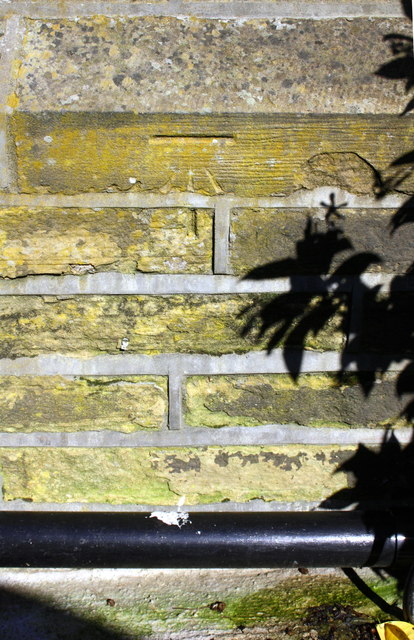
Benchmark on 'Grange Leigh', #10 Carlton Drive
Ordnance Survey cur mark benchmark described on the Bench Mark Database at Link
 Map © Crown Copyright")
TIP: Click the map for more Large scale mapping
- Grid Square
- SE1435, 226 images (more nearby 🔍)
- Photographer
- Roger Templeman (more nearby)
- Date Taken
- Thursday, 10 August, 2017 (more nearby)
- Submitted
- Monday, 22 January, 2018
- Subject Location
-
OSGB36:
 SE 1451 3566 [10m precision]
WGS84: 53:49.0212N 1:46.8657W - Camera Location
-
OSGB36: SE 1451 3566
- View Direction
- EAST (about 90 degrees)