2012
SP6925 : The Meadow
taken 11 years ago, near to Steeple Claydon, Buckinghamshire, England
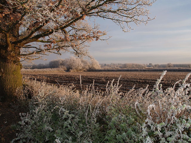
The Meadow
A view across The Meadow, a 7 acre field used historically, 19th Century, as half acre allotments for the villagers from Steeple Claydon. Now being restored to traditional hay meadow
 Map © Crown Copyright")
TIP: Click the map for more Large scale mapping
- Grid Square
- SP6925, 20 images (more nearby 🔍)
- Photographer
- Clive Higgins (more nearby)
- Date Taken
- Wednesday, 12 December, 2012 (more nearby)
- Submitted
- Sunday, 4 February, 2018
- Subject Location
-
OSGB36:
 SP 6967 2568 [10m precision]
WGS84: 51:55.5173N 0:59.2956W - Camera Location
-
OSGB36: SP 6967 2567
- View Direction
- East-northeast (about 67 degrees)