2017
SN9212 : Pot hole near Porth yr Ogof
taken 7 years ago, near to Ystradfellte, Powys, Wales
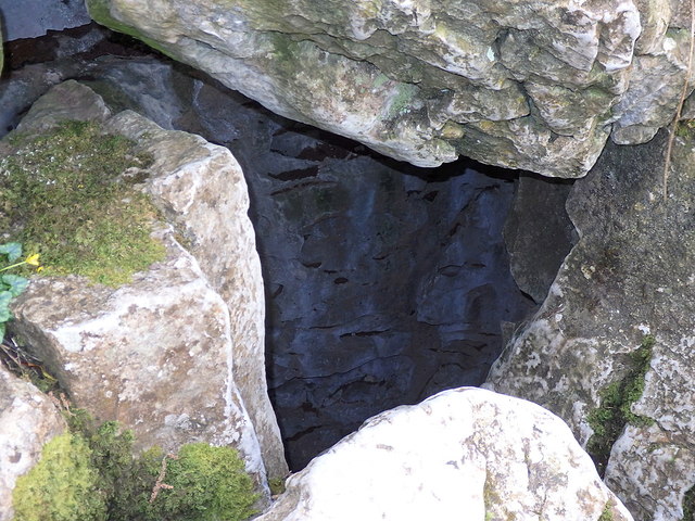
Pot hole near Porth yr Ogof
This entrance to the cave system lies just south of the point where the eastern riverside path alongside the Afon Mellte joins the minor road crossing the valley. The river meanwhile is underground for a section of about 250m while it traverses a section of porous limestone. Photo taken with a fill flash to bring out the rocks inside the gap.
 Map © Crown Copyright")
TIP: Click the map for more Large scale mapping
- Grid Square
- SN9212, 42 images (more nearby 🔍)
- Photographer
- Rudi Winter (more nearby)
- Date Taken
- Tuesday, 11 April, 2017 (more nearby)
- Submitted
- Wednesday, 7 February, 2018
- Subject Location
-
OSGB36:
 SN 9283 1234 [10m precision]
WGS84: 51:47.9642N 3:33.3336W - Camera Location
-
OSGB36: SN 9282 1234
- View Direction
- EAST (about 90 degrees)