2018
SO4658 : Field of oilseed rape
taken 6 years ago, near to Monkland, County of Herefordshire, England
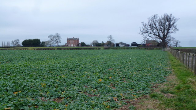
Field of oilseed rape
In the background is Stagbatch House and Farm.
 Map © Crown Copyright")
TIP: Click the map for more Large scale mapping
- Grid Square
- SO4658, 7 images (more nearby 🔍)
- Photographer
- Jonathan Billinger (more nearby)
- Date Taken
- Tuesday, 30 January, 2018 (more nearby)
- Submitted
- Monday, 12 February, 2018
- Subject Location
-
OSGB36:
 SO 4684 5813 [10m precision]
WGS84: 52:13.1281N 2:46.7735W - Camera Location
-
OSGB36: SO 4687 5809
- View Direction
- Northwest (about 315 degrees)