C4933 : Bailey Bridge over Lemacrossan River
taken 7 years ago, 3 km from Quigley's Point, Co Donegal, Ireland
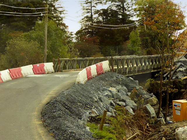
Bailey Bridge over Lemacrossan River
Temporary bridge erected to allow traffic on the road between Carndonagh and Quigley's Point to cross the Lemacrossan River as the original bridge had collapsed during flooding in August 2017 (Link (Archive Link ) Donegal Now)
See C4933 : Roadworks and Diversion at Magheralahan.
See C4933 : Roadworks and Diversion at Magheralahan.
![Creative Commons Licence [Some Rights Reserved]](https://s1.geograph.org.uk/img/somerights20.gif)
|
· Find out How to reuse this image ·
Share:
|
|||||
| Start a discussion on C4933 | Suggest an update to this image | Contact the contributor | |||
Loading map... (JavaScript required)
- Grid Square
- C4933, 8 images (more nearby
 )
)
- Photographer
- David Dixon (find more nearby)
- Date Taken
- Tuesday, 26 September, 2017 (more nearby)
- Submitted
- Sunday, 18 February, 2018
- Geographical Context
- Road (from Tags)
- Subject Location
-
Irish:
 C 492 332 [100m precision]
WGS84: 55:8.6345N 7:13.7231W - Camera Location
-
Irish: C 492 332
- View Direction
- SOUTH (about 180 degrees)
Other Tags
This page has been viewed about 67 times.
View this location:
KML (Google Earth) ·
Google Maps ·
Bing Maps ·
Geograph Coverage Map ·
More Links for this image