J3575 : Information board & signpost, Belfast
taken 6 years ago, near to Belfast, Co Antrim, Northern Ireland
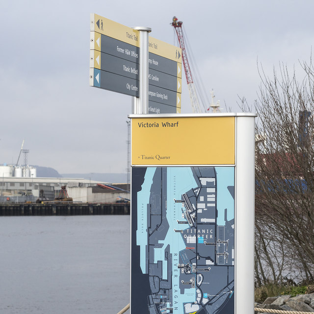
A pedestrian path in part of the Titanic Quarter not previously accessible to the public.
Built in accordance with the following planning permissions:
Z/2014/1714/F (approved 9 March 2016) Construction of a new pedestrian walkway along Victoria Wharf linking Titanic Slipway to Alexandra Dock. Victoria Wharf Titanic Quarter Queens Road Queens Island Belfast BT3 9DT and LA04/2016/2430/F (approved 19 January 2017) Installation of Mew Island Optic within transparent structure. Victoria Wharf Titanic Quarter Queens Road Queens Island Belfast BT3 9DT.
The optic is one originally installed in Mew Island lighthouse Link.
Hall McKnight (architects) describe the scheme as This project is located in the historic area of the Harland and Wolff Shipyard where the Titanic was built. The proposal is for a boardwalk that connects the urban park of the Titanic Signature Project to the Alexandra Dock and the historic Pump House. The proposal coexists with some of the remaining industrial archaeology of the site, including rails for old steam cranes and the defunct steam cranes themselves.
3 sheet steel pavilions create resting positions from which the city, the hills and the horizon may be viewed. Each pavilion is based on grids of 3 distinct triangles of equal area.
![Creative Commons Licence [Some Rights Reserved]](https://s1.geograph.org.uk/img/somerights20.gif)
|
· Find out How to reuse this image ·
Share:
|
|||||
| Start a discussion on J3575 | Suggest an update to this image | Contact the contributor | |||
- Grid Square
- J3575, 1038 images (more nearby
 )
)
- Photographer
- Rossographer (find more nearby)
- Date Taken
- Monday, 12 March, 2018 (more nearby)
- Submitted
- Monday, 12 March, 2018
- Geographical Context
- Place (from Tags)
- Primary Subject of Photo
- Subject Location
-
Irish:
 J 352 756 [100m precision]
WGS84: 54:36.6618N 5:54.4159W - Camera Location
-
Irish: J 352 756
- View Direction
- NORTH (about 0 degrees)
Other Tags