NY7868 : Housesteads Fort, Hospital
taken 10 years ago, 4 km N of Bardon Mill, Northumberland, England
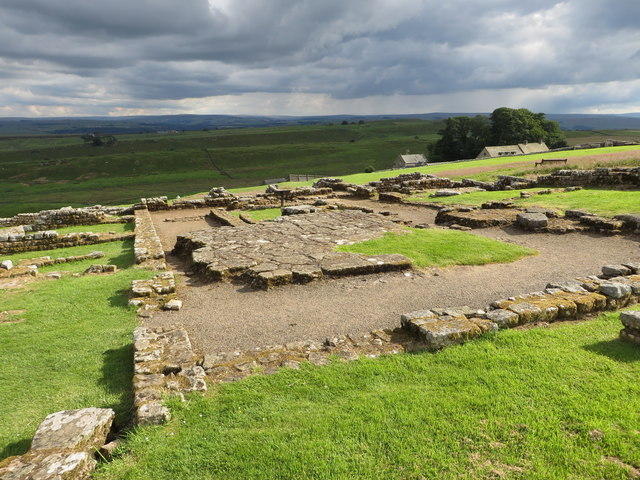
Housesteads (Vercovium) is the best-known fort on Hadrian's Wall, and is one of the most iconic sites of the Roman Empire. This is partly due to the considerable amount of excavation that has taken place here and also because of its location, high on an exposed ridge offering magnificent views. It is the most complete Roman Fort in Britain
The fort was built of stone around AD124, soon after the construction of the Wall began in AD122. Vercovicium was built overlying the original Broad Wall foundation and Turret 36B. A substantial civil settlement (vicus) existed to the south, outside the fort, and some of the stone foundations can still be seen
Many centuries after the Romans left, Housesteads became the haunt of 'rank robbers', including the notorious Armstrong gang of 'border reivers'. The remains of a fortified Elizabethan bastle house can still be seen near the south gate.
The site is now owned by the National Trust and is currently in the care of English Heritage. Finds from Vercovicium can be seen in the site museum, in the museum at Chester, and in the Museum of Antiquities in Newcastle upon Tyne.
LinkHousesteads Roman Fort (English Heritage)
Link
Link
Link
 Map © Crown Copyright")
- Grid Square
- NY7868, 274 images (more nearby 🔍)
- Photographer
- Duncan Graham (more nearby)
- Date Taken
- Sunday, 6 July, 2014 (more nearby)
- Submitted
- Tuesday, 13 March, 2018
- Subject Location
-
OSGB36:
 NY 7896 6879 [10m precision]
WGS84: 55:0.7928N 2:19.8327W - Camera Location
-
OSGB36: NY 7896 6879
- View Direction
- SOUTH (about 180 degrees)