2018
TQ3088 : Crouch End Country Lane
taken 6 years ago, near to Hornsey, Haringey, England
This is 1 of 31 images, with title starting with Crouch End in this square
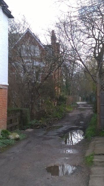
Crouch End Country Lane
Looking east down the track that bears the street name Abbots Terrace reminds one that Crouch End was until the modern era just a village in Middlesex. Those fortunate or wealthy enough to live there now regard it as an urban village with its own very hip identity.
 Map © Crown Copyright")
TIP: Click the map for more Large scale mapping
- Grid Square
- TQ3088, 276 images (more nearby 🔍)
- Photographer
- John Kingdon (more nearby)
- Date Taken
- Tuesday, 13 March, 2018 (more nearby)
- Submitted
- Friday, 16 March, 2018
- Subject Location
-
OSGB36:
 TQ 3027 8817 [10m precision]
WGS84: 51:34.6409N 0:7.2867W - Camera Location
-
OSGB36: TQ 3026 8816
- View Direction
- East-northeast (about 67 degrees)