2002
SK4554 : Pinxton Wharf
taken 22 years ago, near to Pinxton, Derbyshire, England
This is 1 of 5 images, with title Pinxton Wharf in this square
Pinxton Wharf
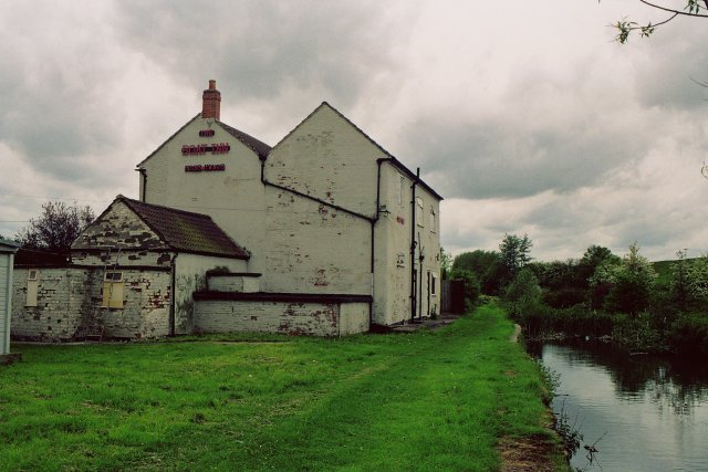
Not just another pub geograph! Pinxton Wharf is the northern terminus of the Cromford Canal Link , which opened up local coalfields and Pinxton porcelain to a wide market via the Erewash Canal. From here, an early railway (the Mansfield and Pinxton) was opened in 1819 to connect Mansfield with the canal system. Tickets to travel on the horse drawn line could be bought at the Boat Inn.
 Map © Crown Copyright")
TIP: Click the map for more Large scale mapping
- Grid Square
- SK4554, 31 images (more nearby 🔍)
- Photographer
- Nick Leverton (more nearby)
- Date Taken
- 2002 (more nearby)
- Submitted
- Tuesday, 26 April, 2005
- Subject Location
-
OSGB36:
 SK 45 54 [1000m precision]
WGS84: 53:5.1472N 1:19.3280W