S6913 : Navigation Light
taken 6 years ago, 3 km from Ballyhack, Co Wexford, Ireland
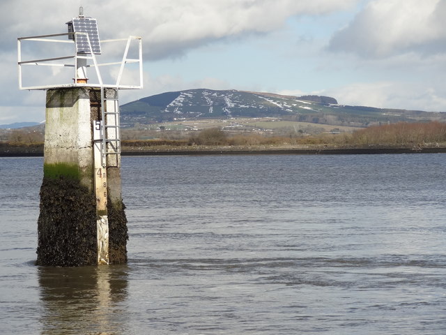
Navigation Light
A navigation light and marker by Skeagh Rock at Russianside, Cheekpoint, Co. Waterford.
Some snow remains on the hills in Co. Wexford in the distance.
Some snow remains on the hills in Co. Wexford in the distance.
![Creative Commons Licence [Some Rights Reserved]](https://s1.geograph.org.uk/img/somerights20.gif)
|
· Find out How to reuse this image ·
Share:
|
|||||
| Start a discussion on S6913 | Suggest an update to this image | Contact the contributor | |||
Loading map... (JavaScript required)
- Grid Square
- S6913 (more nearby
 )
)
- Photographer
- Redmond O'Brien (find more nearby)
- Date Taken
- Thursday, 8 March, 2018 (more nearby)
- Submitted
- Tuesday, 20 March, 2018
- Geographical Context
- Primary Subject of Photo
- Subject Location
-
Irish:
 S 690 137 [100m precision]
WGS84: 52:16.3005N 6:59.3784W - Camera Location
-
Irish: S 690 137
- View Direction
- East-northeast (about 67 degrees)
This page has been viewed about 34 times.
View this location:
KML (Google Earth) ·
Google Maps ·
Bing Maps ·
Geograph Coverage Map ·
More Links for this image
·
Bing Maps ·
Geograph Coverage Map ·
More Links for this image