J3975 : Site adjacent to 392/394 Belmont Road, Belfast (March 2018)
taken 6 years ago, 3 km from Dundonald, Co Down, Northern Ireland
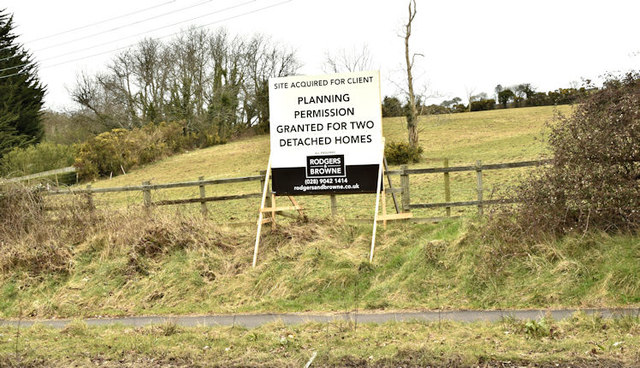
Site adjacent to 392/394 Belmont Road, Belfast (March 2018)
A site with the following planning permissions (24 May 2015) Z/2014/1207/O Proposed development of 2no. detached dwellings with garages and all other associated site works Lands adjacent to 392 and 394 Belmont Road Belfast BT4 and (23 March 2017) LA04/2016/1728/O Erection of 2 detached dwellings with garages and all other associated site works Lands adjacent to 392 and 394 Belmont Road Belfast BT4. Also the subject of a current (3 January 2018) application LA04/2018/0134/RM Proposed development of 2 no. detached dwellings with garages and all other associated site works Site adjacent to 392 & 394 Belmont Road Belfast BT4.
It has existing houses on both sides and is inside the 30mph zone.
I have no connection with the proposed development and cannot enter into correspondence.
It has existing houses on both sides and is inside the 30mph zone.
I have no connection with the proposed development and cannot enter into correspondence.
The Belmont Road, Belfast
The Belmont Road runs from the Holywood Road, at Gelstons Corner, through suburban east Belfast, to Craigantlet hill just outside the built-up area.
![Creative Commons Licence [Some Rights Reserved]](https://s1.geograph.org.uk/img/somerights20.gif)
|
· Find out How to reuse this image ·
Share:
|
|||||
| Start a discussion on J3975 | Suggest an update to this image | Contact the contributor | |||
Loading map... (JavaScript required)
- Grid Square
- J3975, 81 images (more nearby
 )
)
- Photographer
- Albert Bridge (find more nearby)
- Date Taken
- Thursday, 22 March, 2018 (more nearby)
- Submitted
- Thursday, 22 March, 2018
- Geographical Context
- Primary Subject of Photo
- Place (from Tags)
- Subject Location
-
Irish:
 J 396 752 [100m precision]
WGS84: 54:36.3540N 5:50.4012W - Camera Location
-
Irish: J 396 752
- View Direction
- North-northeast (about 22 degrees)
Other Tags
This page has been viewed about 99 times.
View this location:
KML (Google Earth) ·
Google Maps ·
Bing Maps ·
Geograph Coverage Map ·
More Links for this image
·
Bing Maps ·
Geograph Coverage Map ·
More Links for this image