2007
NN8731 : Deserted settlement of Craignavar
taken 17 years ago, near to Newton, Perth And Kinross, Scotland
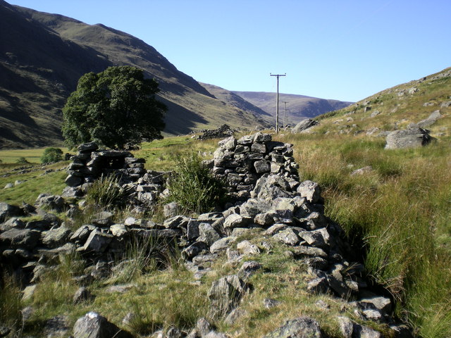
Deserted settlement of Craignavar
Also known as Coraignafarrer this is a settlement of 18 structures at an altitude of 240m on the south facing slope of Meall Reamhar above the valley of River Almond.
 Map © Crown Copyright")
TIP: Click the map for more Large scale mapping
- Grid Square
- NN8731, 17 images (more nearby 🔍)
- Photographer
- John Hughes (more nearby)
- Date Taken
- Monday, 1 October, 2007 (more nearby)
- Submitted
- Wednesday, 3 October, 2007
- Subject Location
-
OSGB36:
 NN 878 317 [100m precision]
WGS84: 56:27.8802N 3:49.3353W - Camera Location
-
OSGB36: NN 879 317
- View Direction
- WEST (about 270 degrees)