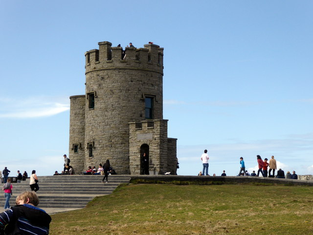
R0392 : O'Brien's Tower, Cliffs Of Moher
taken 6 years ago, 5 km NNW of Liscannor, Co Clare, Ireland
This is 1 of 8 images, with title O'Brien's Tower, Cliffs Of Moher in this square
O'Brien's Tower, Cliffs Of Moher
Billed as Irelands most visited natural attraction, the Cliffs of Moher are a 5 mile stretch of almost sheer cliffs consisting of bands of sandstone, siltstone, mudstone and shale rising to a maximum height of over 700 feet. They take their name from a former fort called Moher (or Mhothair) which stood on the Hags Head, at the southern end of the line of cliffs, but which was demolished in 1808, during the Napoleonic Wars, to be replaced by the signal tower that now stands there. Near the highest point stands OBriens Tower, built in 1835 by Cornelius OBrien as a viewing point for tourists.
See other images of Cliffs of Moher
See other images of Cliffs of Moher
![Creative Commons Licence [Some Rights Reserved]](https://s1.geograph.org.uk/img/somerights20.gif)
|
· Find out How to reuse this image ·
Share:
|
|||||
| Start a discussion on R0392 | Suggest an update to this image | Contact the contributor | |||
Loading map... (JavaScript required)
- Grid Square
- R0392, 100 images (more nearby
 )
)
- Photographer
- PAUL FARMER (find more nearby)
- Date Taken
- Saturday, 7 April, 2018 (more nearby)
- Submitted
- Sunday, 15 April, 2018
- Geographical Context
- Primary Subject of Photo
- Building Type (from Tags)
- Subject Location
-
Irish:
 R 039 923 [100m precision]
WGS84: 52:58.3952N 9:25.8385W - Camera Location
-
Irish: R 039 922
- View Direction
- NORTH (about 0 degrees)
Other Tags
This page has been viewed about 117 times.
View this location:
KML (Google Earth) ·
Google Maps ·
Bing Maps ·
Geograph Coverage Map ·
More Links for this image
·
Bing Maps ·
Geograph Coverage Map ·
More Links for this image